
Everybody knows that “Africa” refers to a large continent, from the Sahara desert to tropical jungles. Maybe you can name some of the 53+ nations – Somalia, Nigeria, Sudan, Egypt – thanks to news stories about corrupt dictatorships, unmet basic needs, pirates and kidnapping.
Please see the map below to get a perspective on distances. Most European countries fit into the area known as North Africa (Egypt, Libya, etc.). The “Horn of Africa” (Ethiopia, Somalia etc.) across from the Arabian peninsula, contains as much geography as the subcontinent of India. It might be included in “eastern Africa”, which extends south through Kenya and Tanzania. “Southern Africa” is 5-8 countries: depending on purpose of classification, countries just to the north (Zimbabwe, Mozambique etc.) could be put in any of the surrounding regions. “Central Africa” includes the rest of the area which would fit into China in the map: the Congo river area east to Rwanda, north to Chad, and west through Gabon.
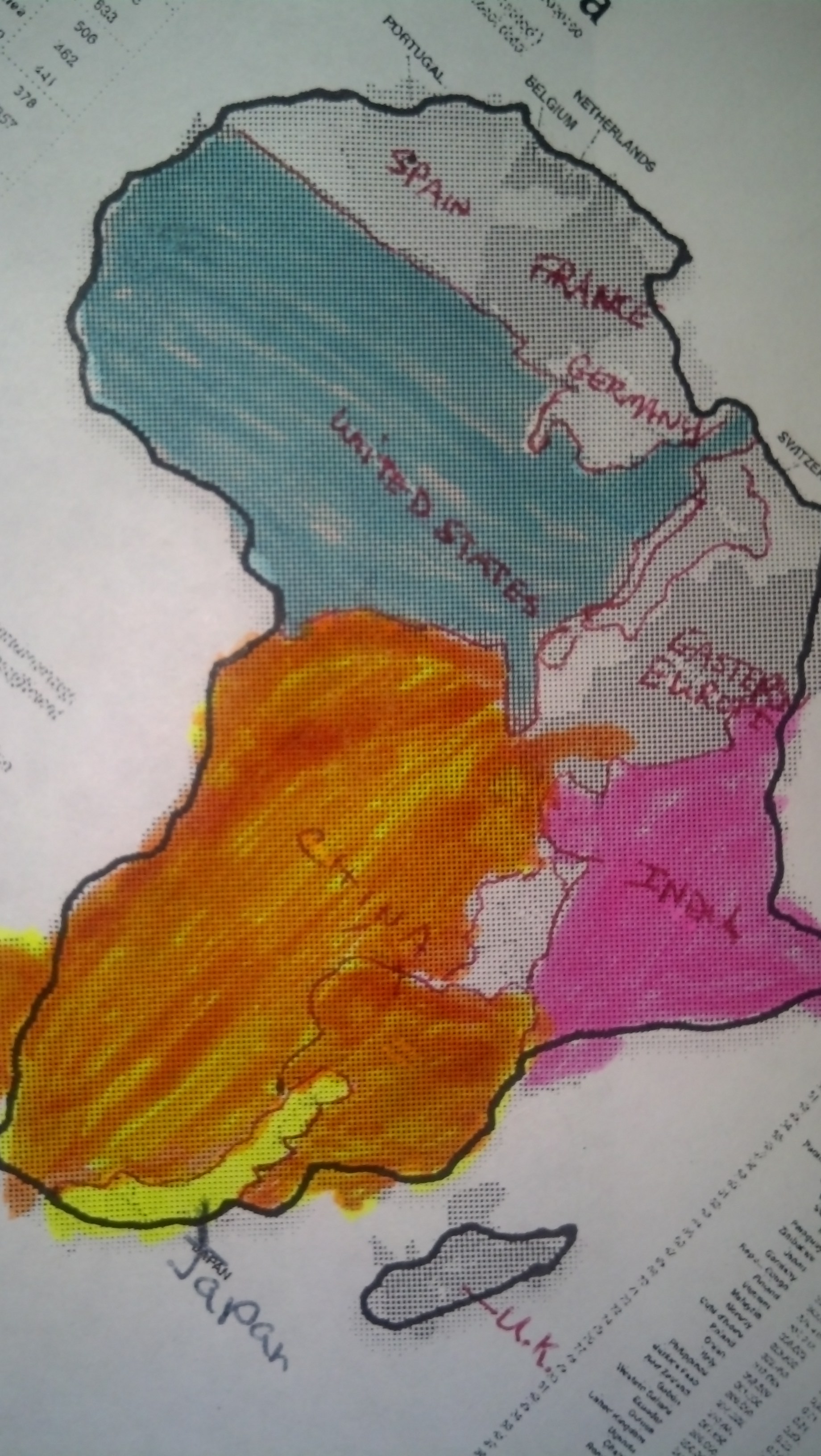
West Africa is just a little smaller than the area overlaid by the U.S.A.’s lower 48 states. (Ghana’s position is equivalent to southern Arizona.) Distances are more than miles. There are no interstate highways, and plenty of mountains, jungles and desert. Instead of a single colonial language, states were run in French, German, Dutch, Portuguese and English, and have inherited those differences. Each colonial boundary included many native language groups and diverse political groupings. Events in Mali or Sierra Leone will be even more distant from our home in Accra than the current Oklahoma tornadoes are from North Newton, Kansas.
There’s no quiz. We just wanted to introduce you to the neighborhood, home of powerful historical events, beautiful cultures, and modern peace heroes.
– Deb

Hello there Wes and Debbie. Great to see this space. I will be following along.